Chyulu Hills Hike ‘N Camp
Let’s Go Camping, Caving & Chasing Sunrises
Let’s go camping.
Let’s go caving.
Let’s chase some of the most beautiful sunrises and sunsets in the world.
Let’s go Chyulu Hills.
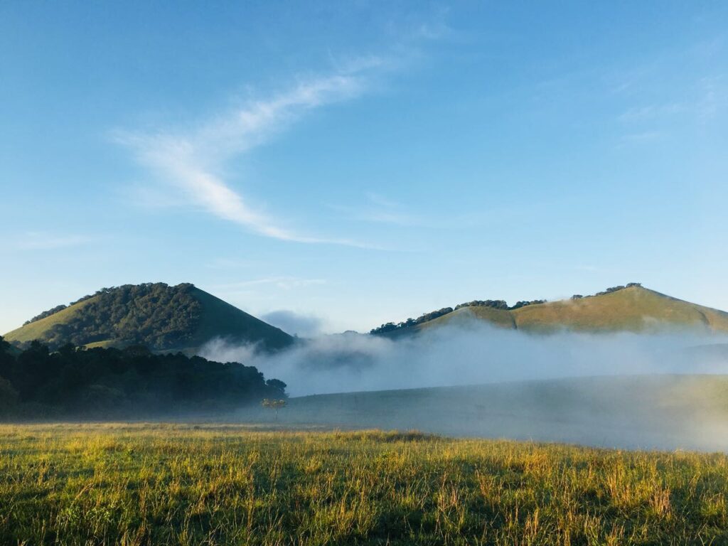
Spend a night immersed in a vast, open wilderness—where rolling hills stretch endlessly and red hot poker trees dot the landscape like brushstrokes on a living canvas. The hills of a thousand hills have called—and the answer is yes.
Where the Plains Meet the Hills
The Chyulu Hills lie along the boundary of the Amboseli and Tsavo plains. Rising to an altitude of 2,188 metres, this volcanic mountain range stretches for approximately 150 kilometres, located about 190km southeast of Nairobi.
Originally part of the greater Tsavo West ecosystem, the eastern slopes were officially gazetted as Chyulu Hills National Park in 1983—protecting one of Kenya’s youngest and most dramatic landscapes.
A Land Shaped by Fire
The Chyulu Hills are home to the deepest known lava tube cave in the world, a reminder of the region’s fiery past. Some volcanic eruptions occurred as recently as 240 years ago, leaving behind the striking Shetani Lava Flow and Chaimu Hill Crater—vast fields of black, solidified magma that remain largely barren and unweathered.
Among local communities, these eruptions live on in legend—stories of spirits spewing fire from the earth, shaping both landscape and lore.
Water Without Rivers
One of the most fascinating features of the Chyulu Hills is that there are no permanent surface rivers, yet the hills act as a critical water catchment area for the surrounding plains.
The porous volcanic rock absorbs rainfall like a sponge, channeling water underground where it slowly travels—taking an estimated 25 years—before resurfacing at Mzima Springs in Tsavo West, nearly 50km south.
Another beneficiary of this underground lifeline is Umani Springs, which sustains the lush 18,000-acre Kibwezi Forest to the northeast—an oasis born from unseen flows.
Camping at Satellite Point
Our journey takes us 35km into the park to a campsite known as Satellite Point, once used as a British Army training base. Sitting at an altitude of about 1,900 metres, this dry, open campsite offers expansive views and a deep sense of solitude.
Remnants of the past still remain—old foundations, storage tanks, and telecommunication masts perched on nearby hills—quietly blending into the wild landscape.
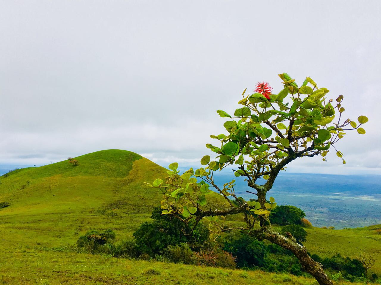
When the Hills Come Alive
Following the short rains of December, the Chyulu Hills transform dramatically. Fresh grass bursts through what was once scorched earth, creating a striking contrast that signals renewal across the plains.
Local pastoral communities traditionally use controlled bush fires during dry seasons to clear old grass, making way for tender new growth after the rains—ideal for grazing and equally perfect for hiking.
This season also brings spectacular displays of red hot poker trees in bloom, splashing colour across valleys and between rounded hilltops. It is, without question, the best time to explore the Chyulu Hills on foot.
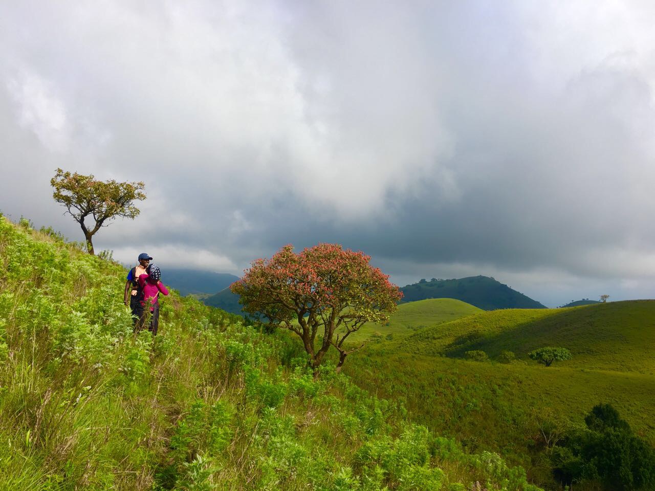
Walking a Living Wilderness
Due to the vastness of the range and its healthy wildlife population, the landscape is crisscrossed by animal trails—natural pathways that guide us through open, undulating terrain under the leadership of a professional guide.
Stretching over 100km from end to end, the Chyulu Hills offer endless possibilities:
- Gentle hill climbs
- Wide-open views in every direction
- Tree groves tucked between slopes
- Quiet, meditative walking
Rather than dramatic cliffs and deep valleys, expect soft rolling hills and subtle natural wonders—like hills split in two, one side grass-covered, the other forested. These patterns are believed to result from wind direction and fire paths, leaving parts of the landscape untouched.
Why Chyulu Hills?
Because this is a place to slow down.
To wander without urgency.
To reconnect with earth, fire, water, and sky.
This is camping with space.
Hiking with silence.
A landscape that reminds you how vast the world really is.
Chyulu Hills is not just a destination—it’s a vibe!.

